Zambia
Visa Application


Super User
Contact
Address: 5th Alhursh Street - Um Somaq Amman Jordan
B.O Box: 1235 - Area Code 11821 Amman
Telefax: +962 6 55 20 55 4
Mobile1: +962 79 520 5 520
Mobile2: +962 77 520 5 520
Email:
This email address is being protected from spambots. You need JavaScript enabled to view it.
Web: www.Zambia-jo.com
Community Projects
| Project Luangwa |
| Project Luangwa is a charitable organisation which aims to help the local community in and around South Luangwa improve their economic prospects through developing schools. |
Conservation
 |
Zambia Wildlife Authority |
| The Zambia Wildlife Authority (ZAWA) is mandated under the Zambia Wildlife Act No. 12 of 1998 to manage and conserve Zambia’s wildlife | |
 |
Game Rangers International |
| Game Rangers International is a Zambian conservation NGO established in 2008. It was founded with the specific aim of assisting the wildlife authorities and communities in the Kafue National Park. | |
 |
Zambian Carnivore Programme |
| The Zambian Carnivore Programme (ZCP) is a non-profit Zambian-registered trust dedicated to conserving large carnivores and the ecosystems in which they reside. | |
 |
South Luangwa Conservation Society |
| The SLCS and ZCP seek to conserve, restore and protect the natural environment in Zambia. Read on to find out what they do and how you can help. | |
 |
Conservation Lake Tanganyika |
| Conservation Lake Tanganyika (CLT) seeks to promote and preserve the biodiversity of Lake Tanganyika for the sustainable benefit for all its inhabitants. | |
 |
Conservation Lower Zambezi |
| Providing a safe refuge for elephants and other wildlife of the Lower Zambezi National Park. | |
 |
Chimfunshi Chimp Sanctuary |
| David and Sheila Siddle’s chimp and wild animal care and reabilitation sanctuary. | |
 |
Chipembele Wildlife Education Trust |
| Chipembele is an international award winning charity working at grass roots level. |
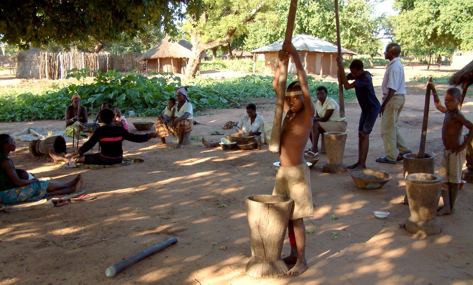
The Zambian People
ith a population of less than 15 million, Zambia comprises an amazing 72 ethnic groups, most of which are bantu-speaking. About 90% of the population fall into 9 major ethnolinguistic groups: the Nyanja-Chewa; Bemba; Tonga; Tumbuka; Lunda; Luvale; Kaonde; Nkoya; and Lozi.
Zambia is also home to a thriving Asian community, predominantly of Indian and Chinese origin, numbering around 100,000, as well as a number of European expatriates, some of whom were invited to settle in Zambia by the local government having been cast off their farms in neighbouring Zimbabwe.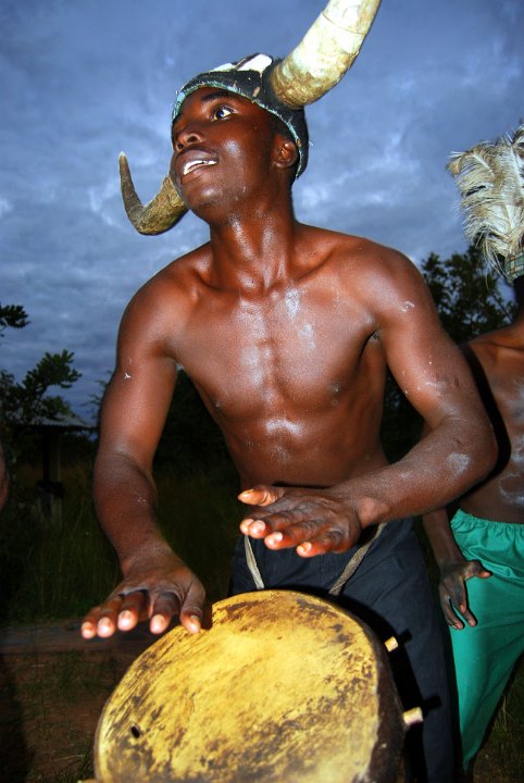
All this makes Zambia home to a vibrant mix of cultures, traditions and peoples, and Zambia is also widely-considered to be one of the friendliest and most welcoming nations in the world.
Zambian Culture
Zambia's contemporary culture is a blend of values, norms, material and spiritual traditions of more than 70 ethnically diverse people. Most of the tribes of Zambia moved into the area in a series of migratory waves a few centuries ago. They grew in numbers and many travelled in search of establishing new kingdoms, farming land and pastures.
Before the colonial period, the region now known as Zambia was the home of a number of free states. Each having comprehensive economic links with each other and the outside world along trade routes to the east and west coast of Africa. The main exports were copper, ivory and slaves in exchange for textiles, jewellery, salt and hardware. read more
Zambian Festivals
There are more than 20 annual traditional ceremonies in Zambia, manifesting customs, social life, rituals, oral history, material and spiritual culture. If you have the opportunity to attend one, it is well worthwhile to do so. They provide a valuable insight to a traditional culture that has been passed down from generation to generation.
The decline of traditional customs and culture has been brought about by the infiltration of the west and western ways and the melting pot of various tribes living in the same areas. There has recently been a realisation of the value of traditions and a conscious effort is being made to preserve them. read more
Tribes in Zambia
With over 70 different tribes in Zambia, there is wide cultural diversity. Interestingly enough however, it is one of the few countries in Africa with very little tribal animosity, and the existence of so many tribes has proved less of a political problem than in many other African states. The main tribes are the Lozi, the Bemba, the Ngoni, the Tonga, the Luvale and the Kaonde.
Vegetation
hile it is true that Zambia lacks the spectacular mountains of most of its neighbours, it has more intact miombo woodland than any other country. It also has many large lakes and vast floodplains. The Zambezi and several of its tributaries are larger than any river to the south. There are larger and more spectacular waterfalls in Zambia than in the whole of the rest of the subcontinent, including five major waterfalls on the Kalungwishi River system alone.
Zambia occupies a central position in the Zambesian Region, which is the summer-rainfall belt of southern tropical Africa. Within the region the natural vegetation is largely determined by altitude, rainfall and soils.
Common Names
In countries where the English language has been in use for centuries, such as the United States, South Africa and Australia, many plants are known by common English names. Zambia has a vegetation quite different from those countries and very few species have accepted English names. The tendency to borrow names like “Wild Medlar” is of little help to local Zambians who are never likely to see a medlar, and would not recognize the similarity if they did. Ecologists in this country have preferred to use one of the local names. There is no problem with “mopane” or “baobab”, which are established internationally, but there seems little point in coining a whole new system of names when all plants already have very specific botanical names. It is true that the Latin names can be difficult to get your tongue around, but are essential to be sure of exactly which wild fig, for example, you are looking at. Knowing the botanical name will allow you to find out the local name.
Ecological Zones
Zambia can conveniently be divided into the following ecological zones:
- Plateau – with higher rainfall
- Plateau – with medium rainfall
- Montane
- Kalahari Sand – with higher rainfall
- Kalahari Sand – with medium rainfall
- Valley


y African standards, Zambia is well-known ornithologically. So far 740 species have been recorded here.
Avifaunal Areas of Zambia
To a large extent Zambia’s avifauna is that of the Central African Plateau. The vegetation is principally miombo woodland, bisected by grassy dambos along drainage lines. In some areas the miombo woodland is replaced by other woodland types, dry forest or thicket. Along watercourses there may be riparian forest, or in wetter areas in the north, wet evergreen forest. Most of these habitats have a distinctive set of birds.
Zambia also has low-lying valleys. These include the Luangwa and Middle Zambezi Valleys and the country between Lakes Tanganyika and Mweru. A number of birds found in these areas are different from those occurring at higher altitudes.
A very small part of Zambia has montane altitudes. The avifauna here is quite different from that of the rest of the country and includes several species with very limited ranges.
Codes used are: (E)Endemic (found only in) to this habitat. (m) Established migrant, (n) (s) (e) (w) Found only in northern/southern/eastern/ western Zambia.
Conservation
According to criteria established by Birdlife International, the following birds recorded in Zambia are threatened:
Extinct: none
Threatened: critical: none
Threatened: endangered : White-winged Flufftail (no certain records), Black-cheeked Lovebird
Threatened: vulnerable: Slaty Egret, Cape Vulture (only a migrant to Zambia), Lesser Kestrel, Taita Falcon, Corn Crake, Wattled Crane, White-chested Tinkerbird (may be aberrant Golden-rumped Tinkerbird), Blue Swallow, Papyrus Yellow Warbler
Near-threatened: Madagascar Squacco Heron, Shoebill, Lesser Flamingo, Pallid Harrier, Black-winged Pratincole, Great Snipe, Chaplin’s Barbet, Grimwood’s Longclaw, Churring Cisticola.


The History of Zambia
he Great Rift Valley, which cleaves the earth from the Lower Zambezi River in Southern Zambia to the headwaters of the Nile in Egypt, is now known to be one of the cradles of the human race, and Zambia's present population lives on lands that have been inhabited by our forebears for uncountable aeons.
Archaeologists have established that in the northern African Rift Valley, the civilizing process got underway at least 3 million years ago, and crude stone implements, similar to some of that age found in Kenya, have also been found beside the Zambezi River.
Early stone age sites have been unearthed in many parts of Zambia, the most significant being at the Kalambo Falls in the North and at Victoria Falls in the south. At the former there is evidence that primitive humans began using fire systematically some 60,000 years ago. At the latter, a complex has been fully exposed showing the development of skills from the most distant past (this 'dig' is enclosed at the Field Museum at the Victoria Falls).
The skull of Broken Hill Man, dated to 70,000 years ago, gives an indication of what humans of that period looked like.
It was during the next phase – the middle Stone Age – with its refinement in the manufacture of tools, differentiation between populations, and burial of the dead, that modern man probably emerged in Zambia, at least 25 000 years ago.
We may imagine family groups of small-statured people living near water and sustaining themselves by hunting the abundant game as well as gathering fruits, tubers and honey from their surroundings (some skulls show serious tooth decay caused by honey?) They would often be on the move, following the antelope as they migrated with the seasons. By 15,000 years ago, the Late Stone Age commenced.
People began to live in caves and rock shelters, the walls of which they decorated with paintings. Very few of these have survived Zambia's seasonally humid climate, and those which have, do not display the sophistication found in the Rock Art found in Zimbabwe or South Africa. But a surviving drawing of an eland at Katolola in the Eastern Province suggests that this art was more than decorative, that it had a ritual or religious meaning: it has been shown in South Africa that this animal was sacred to the Late Stone Age people there.
This spiritual and artistic development occurred alongside another, the invention of the bow and arrow, which revolutionised hunting and also gave humans a mechanical weapon of war, a musical instrument, and a method of starting fire! It has been determined that the people of the Late Stone Age neither tilled the soil nor kept livestock.
New Arrivals
The Zambian Stone Age people probably resembled the present-day San, but towards the end of the period here, there is evidence, from skeletal remains of Negroid physical features, that the hegemony of the aboriginal population was coming to an end. During the centuries between 300 BC and AD 400 Zambia was gradually taken over by Negroid people, who by the later date had occupied the whole country. This was achieved slowly, which allowed the earlier way of life to persist into the present era. read more
The European Factor
The wealth of the Indian Ocean trade was one of the elements (another was to spread Christianity) that in the 15th Century inspired the Portuguese, who had recently reconquered their country from Muslim Moors, to embark on their bold 'Voyages of Discovery'. read more
Invasions from the South
Perhaps as a response to foreign intrusions in southern Africa, Shaka of the Zulu and Nguni clan, set about creating a centralized militaristic state in the early 19th century. Surrounding peoples who did not voluntarily agree to absorption into the growing Zulu empire had no option but to flee for survival. Three of these groups were to make a forceful impact on Zambia, 1500 km to the north of the Zulu heartland in eastern South Africa. read more
Missionaries and Colonisers
In 1840 David Livingstone, a 27 year old Scottish doctor and ordained minister, sailed from Britain to the Cape to work as a medical evangelist with the London Missionary Society. He was to open central Africa to the gaze of British imperialists. Meanwhile, Portugal was planning to consolidate its African territories by uniting Angola and Mozambique across the central plateau. read more
Empire
With considerable help from both Coillard and Dupont, the British imperialist Cecil John Rhodes' British South African Company (BSAC) had been able to take over the whole of Zambia by the end of the 19th century: that Frenchmen should have served the British Empire so well is one of the quirks of history! read more
King Copper
The discovery and opening up during the late 1920s and 1930s of the rich underground ore bodies along the Zambian Copperbelt were soon to make that small region – 120 km long by 40 km wide – one of the worlds' most concentrated and renowned mining areas. read more
Federation
The nationalist movement was given impetus in the early 1950s when the Colonial Office agreed to have Northern Rhodesia joined in a federation with Nyasaland (Malawi), a British 'protectorate', and Southern Rhodesia (Zimbabwe). Southern Rhodesia, under White settler rule, was bankrupt, and saw Northern Rhodesia, with its copper wealth as, to quote one of its political figures, a 'milch cow'.
The Federation was dissolved in 1963, its only enduring monument the Kariba Dam across the Zambezi, intended by the federalists to bind Northern and southern Rhodesia forever. In January the following year Zambia's first universal adult suffrage elections were held and though the ANC performed well in a few substantial areas, UNIP won convincingly, Kaunda becoming Prime Minister. Then at midnight on 24th October 1964, Zambia became an independent republic with him as president.
The one-party state was abolished and free elections were held in October 1991. Kaunda and UNIP were defeated eighty per cent to twenty per cent by the newly formed Movement for Multi-party Democracy, a broad coalition of different interest groups.
Geography
ambia takes its name from the Zambezi River, which rises in the north-west corner of the country and forms its southern boundary. This landlocked country lies between the latitudes 10o and 18oSouth and longitudes 22o and 33o East.
It’s neighbours are: Congo DR to the north and north west, Tanzania to the north east, Malawi to the east, Mozambique to the south east, Zimbabwe to the south, Botswana and Namibia to the south west and Angola to the West.
Zambia’s 752,000 square kilometres makes it a large country about the size of France, the Netherlands, Belgium and Switzerland combined. It consists for the most part of a high plateau, with an average height of between 1060 and 1363 meters above sea level. (3500 and 4500 ft). Isolated mountain ridges rise to more than 6000 ft with an occasional peak above 7000 ft on the eastern border, called Nyika Plateau. Over most of the country the surface tends to be flat, broken by small hills, the result of countless ages of undisturbed erosion of the underlying crystalline rocks. These rocks contain the bulk of the country’s wealth in the form of minerals, and the 90 mile long corridor known as the Copperbelt, along the north-western part of the country, is the mainstay of the Zambian economy.
The level of the land falls southward from the Congo DR / Zambezi divide in the north towards the Zambezi depression in the South. The plateau is broken by the huge valleys of the Upper Zambezi and its major tributaries, of which the Kafue and Luangwa Rivers are the largest. One result of the plateau formation of Africa generally is the swift discharge of water towards the coast and the interruption of the rivers by waterfalls and rapids. This has made them of little value for transport over their length, but very suitable for hydroelectric schemes and white water rafting adventures.
With the exception of the Northern and Luapula Provinces which are part of the Congo DR basin, Zambia lies on the watershed between the Congo DR and Zambezi River systems. The three great natural lakes of the country, Bangweulu, Mweru and the southern end of Lake Tanganyika are all in the north and are part of the headwaters of the Zaire River. Lake Tanganyika is the second deepest natural lake in the world.
Lake Bangweulu, which with its swamps covers an area of about 3800 square miles, is drained by the Luapula River. This river starts flowing south, then turns west and northwards to pass through Lake Mweru on its way to Congo DR.
Along the southern border of the country stretches Lake Kariba, the largest man-made lake in Africa and the second largest in the world. It is about 280kms long and 40kms across at its widest point.
he general height of the land gives Zambia a more pleasant climate than that experienced in most tropical countries. There are three seasons – cool and dry from May to August, hot and dry from September to November, and warm and wet from December to April. Only in the Valleys of the Zambezi and Luangwa is there excessive heat, particularly in October and, in the wet season, a high humidity. In the warm wet season, frequent heavy showers and thunderstorms occur, followed by spells of bright sunshine. Plants grow profusely and rivers and streams fill up almost overnight. During the cool dry season, night frosts may occur in places sheltered from the wind. The countryside dries up gradually and grass fires, fanned by high winds are a feature of this time of the year. In depressions, frost can occur on cloudless nights. Temperatures rise high during the hot, dry season but new leaves appear on the trees before the start of the rains and new grass brightens the countryside. The main growing period of woody vegetation is between August and November.
Rainfall
While the rainfall pattern over the whole country is similar – between November and March, the amount of rain varies considerably. The climate is affected most by the movement of the inter-tropical convergence zone, which is the meeting place of the sub-tropical high pressure areas of the northern and southern hemispheres. Over the sea, this zone approximates to the equator, and when the sun is overhead at the equator, heavy rains may fall in the equatorial regions of Africa. The zone moves southward with the apparent movement of the sun in the southern summer and brings rain to the greater part of Zambia. In the north of the country rainfall is 1250mm/ (50 inches) or more a year, decreasing southwards to Lusaka where it is about 750mm/ 30 inches annually. South of Lusaka rainfall is dictated more by the east and Southeast trade winds, which have lost much of their humidity by the time they have reached so far inland. Rainfall in this area is between 500 and 75omm / 20 and 30 inches.
In exceptional years the influence of the inter tropical zone is felt much farther to the south, resulting in excessive rain in the Southern Province and partial drought in the north. Except for very rare falls in August, rainfall is confined to the wet season, which sometimes starts as early as October and finishes as early as March. At the height of the wet season it rains on seven or eight days out of ten. Average temperatures are moderated by the height of the plateau. Maxima vary from 15oC to 27oC in the cool season with morning and evening temperatures as low as 6oC to 10oC and occasional frost on calm nights in valleys and hollows which are sheltered from the wind. In the cool season the prevailing wind, dry south easterlies come from the southern hemisphere belt of high pressure. Invasions of cold air from the south-east bring cloudy to overcast conditions. During the hot season maximum temperatures may range from 27oC to 35oC.
The table below shows annual rainfall and representative maximum and minimum temperatures during the hottest and coldest months of the year respectively. It can be seen that annual temperature variation is greatest at Livingstone, the most southerly town, and the smallest at Mbala, the town nearest the equator. Zambia’s vegetation is of the savanna type and over half the country is covered by trees, varying from the more open conditions in the drier south to tall dense woodlands in the north and north-west. These woodlands contain only hardwoods. The trees are bare for a brief period only and the spring leaves appear before the start of the rains. Grass fires spread rapidly in the dry season but new blades of grass soon push through the blackened earth. Zambia’s climate makes possible the cultivation of a wide range of crops; maize, tobacco, cotton, rice, wheat and groundnuts. All kinds of vegetables can be grown, together with citrus fruit, bananas, pineapples, mangoes, avocados and even grapes. Lichis are also a high potential export crop. Tea and coffee are also grown successfully in fact the coffee produced is of a very high quality. Sugar cane is grown both by villagers and commercially.